
Gram Panchayat Map
Grama Panchayat Map 2025
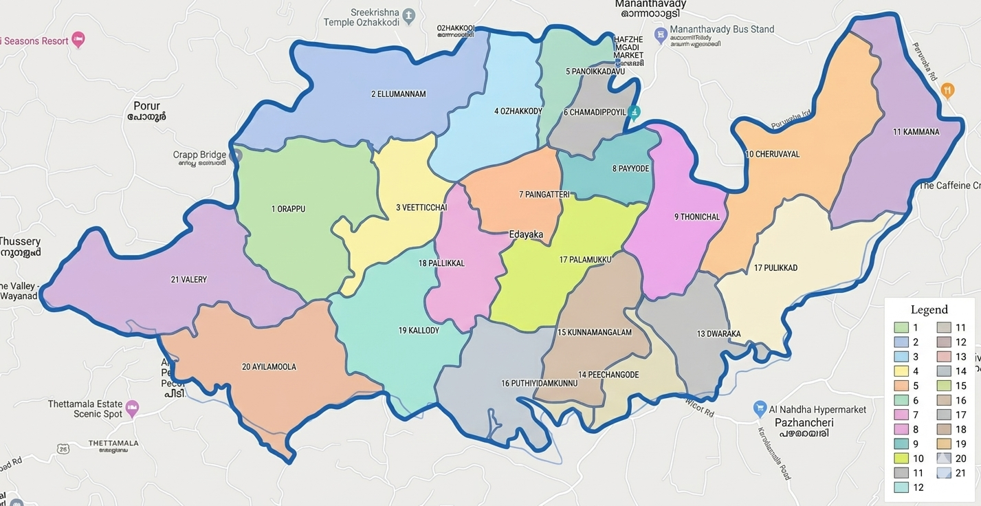
Edavaka Grama Panchayat is an important local self-government institution situated in Mananthavady Taluk of Wayanad District. The Panchayat is well known for its agricultural heritage and natural beauty.
Basic Information
| Details | Information |
|---|---|
| District | Wayanad |
| Taluk | Mananthavady |
| Block Panchayat | Mananthavady |
| Headquarters | Pallikkal (Ellumandam P.O.) |
| Number of Wards | 21 |
| Area | 47.76 Square Kilometres |
| PIN Code | 670645 |
Special Features of Edavaka Grama Panchayat
Edavaka Grama Panchayat is a region that has achieved notable progress in natural resource management, agriculture, rural culture, and infrastructure development. The Panchayat plays an important role in welfare activities and development projects.
Geographical Boundaries
| Direction | Boundaries |
|---|---|
| North | Mananthavady River, Thavinhal Panchayat, Mananthavady Panchayat |
| East | Panamaram Panchayat |
| South | Vellamunda Panchayat |
| West | Thondernad Panchayat |
Location of Edavaka Grama Panchayat
Edavaka Grama Panchayat is located near the Mananthavady region in Wayanad district. It is an area that plays a major role in agriculture, natural resources, water conservation, and rural development.
```
