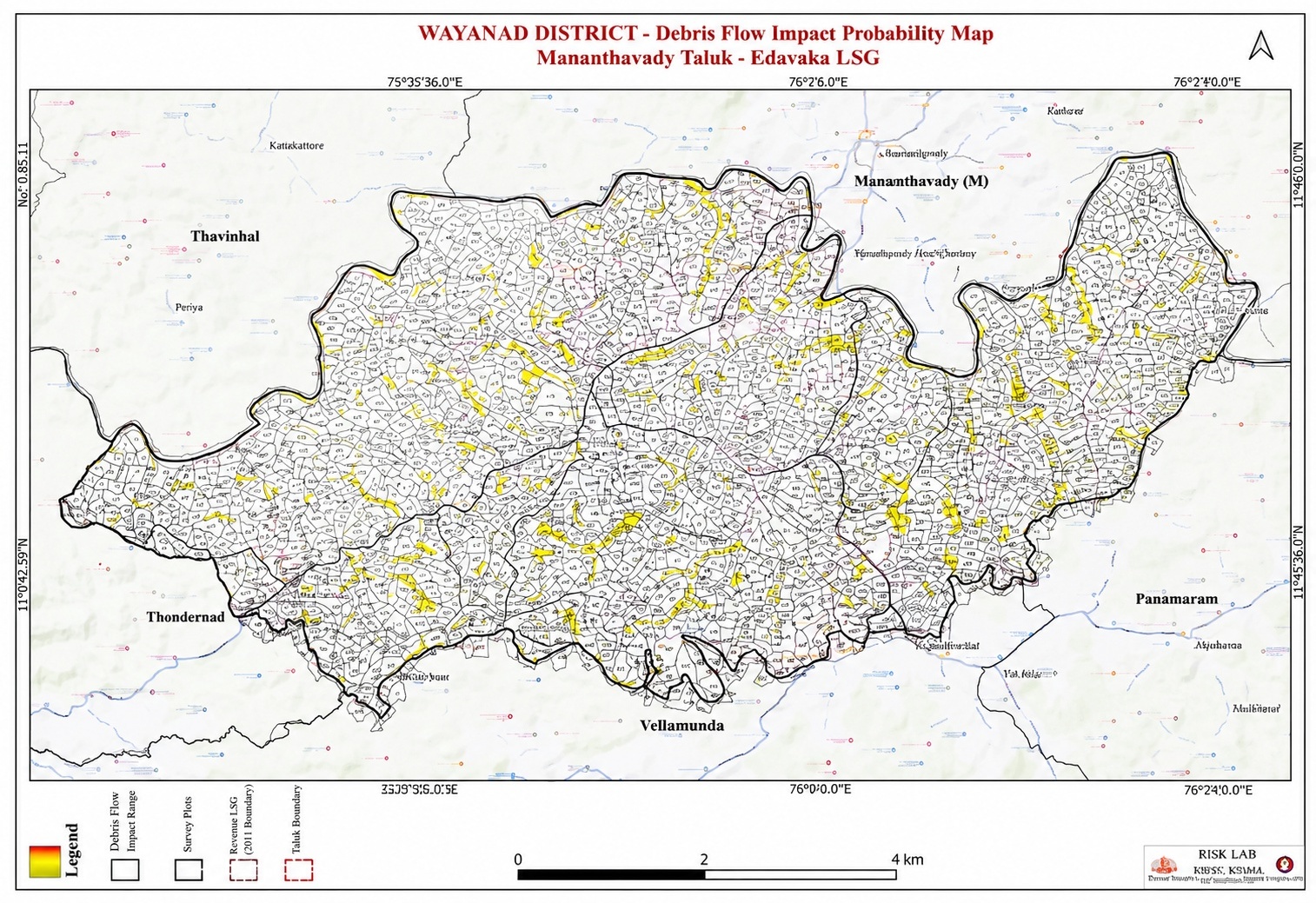
What is a Debris Flow Impact Probability Map?
A Debris Flow is a rapid movement of soil, rocks, tree branches, and other debris downslope, usually triggered by heavy rainfall, landslides, or slope failures.
A Debris Flow Impact Probability Map is a specialized hazard map that identifies areas likely to be affected by such debris flows and indicates the level of risk associated with each location.
📍 What Does the Map Show?
- Areas where debris flows are likely to originate
- Potential flow paths of debris movement
- Low-lying areas that may be impacted
- Risk to houses, roads, bridges, and public infrastructure
- Zones categorized as high, moderate, or low hazard areas
🎨 Meaning of Common Map Colors
🟥 Red (High Probability)
- Area with the highest likelihood of debris flow impact
- Requires special attention and preparedness measures
🟧 Orange / Yellow (Moderate Probability)
- Moderate level of hazard
- Monitoring and precautionary measures are recommended
🟩 Green (Low Probability)
- Relatively low risk of impact
📊 Data Used to Prepare the Map
- Land slope and gradient
- Soil characteristics
- Rainfall intensity and distribution
- Terrain and topography
- Land use and land cover patterns
- Historical landslide and debris flow records
- Drainage and water flow channels
🎯 Applications
- Disaster risk reduction and management planning
- Identifying safer locations for construction and development
- Preparing evacuation and emergency response plans
- Protecting roads, bridges, and critical infrastructure
- Supporting local government and Panchayat development planning
📝 Example
If heavy rainfall occurs on a steep hillside, soil and rocks may move rapidly downslope. This map helps identify which wards, houses, roads, and public facilities located below the slope are most likely to be affected, enabling authorities and residents to take preventive measures in advance.
📌 In Summary
A Debris Flow Impact Probability Map is a hazard assessment map that shows the likelihood of an area being affected by debris flows consisting of soil, rocks, and other materials, helping communities plan and prepare for potential disasters.